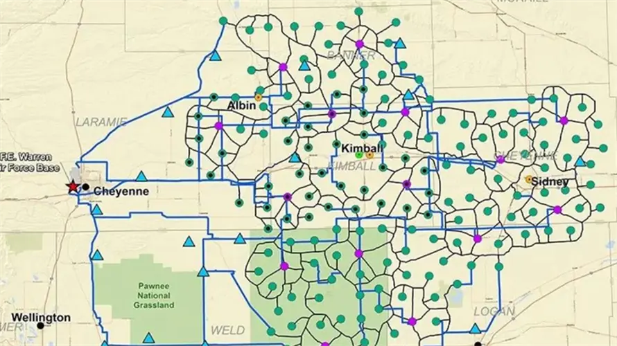
Air Force releases proposed land acquisition map for Sentinel project
KIMBALL, Neb. -- The week that letters will arrive in the mailboxes of affected land owners, the United States Air Force has released a map that show the scope of the Sentinel Program.
Kimball, Banner and Cheyenne counties will be those most affected when the Air Force begins the project that is set to modernize the minuteman missile silos controlled by FE Warren Air Force Base in Cheyenne, Wyo. Weld and Logan counties in Colorado will also see an uptick in activity, however it is Laramie county in Wyoming that will see miles and miles of cables get laid as the minuteman silos are hardwired back to FE Warren Air Force Base.
The yellow "MAF" markings are Missile Alert Facilities while the outlying "LF" markings are Launch Facilities that are do to be upgraded between the fall of 2023 and 2028. The red outline marks a network of cables that are set to be upgraded and/or re-used in the completion of the project.
More information will follow on where temporary housing will be located for the project. Land owners in the mapped area that receive a letter will have the opportunity to meet with the Air Force and Army Corp of Engineers to discuss the acquisition of their land through traditional real estate transactions.