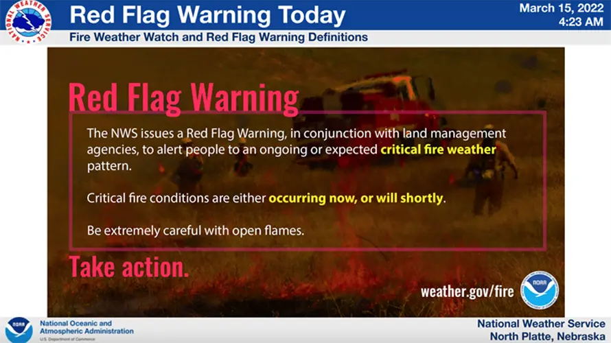
NWS: Critical fire weather conditions likely Tuesday afternoon
A surge of warm dry air, with gusty winds and low afternoon humidity, will create favorable fire weather conditions across unusually dry grasslands across western and central Nebraska Tuesday, according to the National Weather Service.
CHAPPELL - A surge of warm dry air, with gusty winds and low afternoon humidity, will create favorable fire weather conditions across unusually dry grasslands across western and central Nebraska Tuesday, according to the National Weather Service.
A red flag warning is in effect until 8 p.m. MDT for counties across central Nebraska into the the eastern Panhandle. A Red Flag Warning means that critical fire weather conditions are either occurring now, or will shortly. A combination of strong winds, low relative humidity, and warm temperatures can contribute to extreme fire behavior.
Southwest winds will be sustained at 15 to 25 mph, with gusts up to 35 mph. The relative humidity will be as low as 13 percent. The weather service says conditions will become favorable for rapid fire growth and erratic fire behavior. Fires may quickly become out of control. Outdoor burning is not advised.
High temperatures Tuesday in Chappell will reach the upper 60s before dropping back to the mid 50s on Wednesday.
